
This subject isn't the most enjoyable; at least it isn't at the time of the mishap. Later on, though, the occurrence might spin some yarns. Of course one shouldn't run aground, but once the damage is done, it is important to stay calm and not sink below ones dignity (even though the ship might sink). Losing your boat isn't that serious after all. Far more disturbing is the thought of losing your face, that is - to look like a fool. Especially on a sailboat, you easily invite ridicule because of the boat's often eye-catching inclination on top of the reef. If you are alone on the fjord, you have little to fear. But the disadvantage is obvious. You have to rely on self-help. If you have an audience, your dilemma is much worse. Are you going to beg for help - even from a cabin-cruiser? - or should you pretend that everything is routine: You've just got hold of a hundred percent secure anchorage for the night, that's all. Unfortunately this last strategy might bring about some hours of waiting until the next high tide. In the meantime a recommended behaviour would be: Smoke an expensive cigar on the after-deck, read the morning newspaper or a collection of poetry (at least not an introduction to navigation or safety at sea), listen to classic music, do some odd jobs, greet all passing boats politely. If no other boat looms up on the horizon, you are lucky - and might as well while away the time with something else, e.g. make your sweetheart feel good while waiting. That is: if she hadn't turned out when it happened. If you were at the helm, on the other hand, it was one of those things that could easily happen.
Sunday 16 October 2011
Saturday 8 October 2011
Sailing Vestlandet; cruising the West Coast of Norway from Askvoll to Stavanger

Alden - the Norwegian horse - hidden in clouds.
A modern vintage ocean cruiser, a contradiction in terms, was what lured me up the west coast of Norway - Vestlandet -, as far north as Atløya off Askvoll, north of Sognefjorden. Like this I entered waters that I only had a vague notion of from pictures and travelogues. What called me was a classic sailboat, but with modern design born on a drawing board in the Netherlands around the years when I was designed myself. What I never thought would happen did happen; I had bought a boat unseen, a boat that might turn out to be shabby and worn out after nearly 50 years. But it also could turn out to be a treasure. I had bought it out of intuition, but with the owner’s assurance that both the rig and the engine had been renewed. A bonus coming out of the madness was this: Finally I got the opportunity to cruise along almost the entire Norwegian west coast in a wink, from Atløya to Stavanger, on my own boat and without the annoying drawback of a return just as long. Now my crew and I simply took a northbound plane. Then our intention was to sail southwards towards our home city and the boat’s new home-port. Of course I was aware that something would probably go wrong as usual, but never mind.
Trough the window of “our” Wideroe WF124 airplane – constantly expecting the propellers to be thrown off and cause a sudden death – I get my first glimpse of these western waters. The coast doesn’t look that different, though, from my own dear fjords and archipelagos in the Ryfylke region, but this coast is more open and wilder, with steeper mountains and cliffs compared to the soft and friendly Ryfylke, a bit modest like its people. It’s a difficult task to decide which seascape should stand as the prettier. Often completely different appearances prove to be equally fascinating. What fascinates me by this new coast, though, is at least a tiny scent of Nordland, a region made famous for instance trough Knut Hamsun’s novels, but unattainable from where I live due to huge distances and my general shortage of leisure time. Now we are half the way, at least, in Sunnfjord as this region is called, and this is good enough and far enough for a while.
Trough the window of “our” Wideroe WF124 airplane – constantly expecting the propellers to be thrown off and cause a sudden death – I get my first glimpse of these western waters. The coast doesn’t look that different, though, from my own dear fjords and archipelagos in the Ryfylke region, but this coast is more open and wilder, with steeper mountains and cliffs compared to the soft and friendly Ryfylke, a bit modest like its people. It’s a difficult task to decide which seascape should stand as the prettier. Often completely different appearances prove to be equally fascinating. What fascinates me by this new coast, though, is at least a tiny scent of Nordland, a region made famous for instance trough Knut Hamsun’s novels, but unattainable from where I live due to huge distances and my general shortage of leisure time. Now we are half the way, at least, in Sunnfjord as this region is called, and this is good enough and far enough for a while.
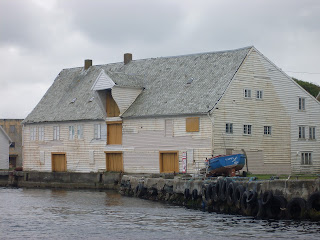
Unfortunately the airplane now turns and follows the long Førdefjorden, with no indication of wanting to throw us off. Suddenly we are far away from the coast, but - unfortunately - Førde is the nearest airport. “Is this the bus to the centre of Førde,” I ask the bus-driver later on, and he shakes his head. Besides, to where else in the world could a shuttle bus at Førde Airport possibly head? Førde – where I've never been before – turns out to be one of the most ugly towns in Norway. Only the bus station is, I admit, a beautiful, modernist building, probably from the early sixties, but this building too has been spoiled by later extensions. Just down the road something big and black has been built, reminding me of the Islamic shrine Ka'ba or something similar, but it's probably meant to be a town hall or a shopping centre, or both, since politics and shopping are one and the same nowadays. Unfortunately, it’s still an hour before our bus departs for the coast, so we decide to explore Førde in the meantime, my crew and I. Then, suddenly, the unbelievable happens. Like an oasis in this jungle of concrete brutalism, the “Rikken” art gallery and hardware shop reveals itself, with opening hours from 11 a.m. to 16.50 p.m. and a phone number to call on any odd hour. Art gallery, music shop or ship chandler, it’s not easy to decide. Here, each shelf is a separate world, and the ruling system, according to the proprietor, is chaos. In this small pocket of surviving culture, we are shown old pictures of Førde as it ones was and still could have been – if it wasn’t for…etc. etc, it’s enough to make us cry. The proprietor gives us some good offers, but we must resist the opportunity to stock up. We do not know what our new ship really needs, but at least we find a superb Beatles poster, designed by Førde artist Oddvar Thorsheim. Apparently he lives just up the hill, and in this gallery his works are everywhere. But now it's time to move on towards our two hours bus ride, jolting on ailing roads before we get to see the coast ones again. Finally we arrive at Askvoll and we immediately run to the general store. Soon the ferry carries us across the small inlet to Atløy where our “jewel” is waiting patiently; a real Pionier E.G. van de Stadt design, 9.10 meter overall, the incarnation of a modern fibreglass cruiser, a neoclassic hull with soft, modernist lines from the late 50's, a design so complete that a worthy owner will accept with light hearth some scratches, some leakages and some layers of muck and mildew accumulated over the years. The previous owner gives us some information, but in a hurry. He is eager to get back to Oslo where he lives. So here we are, suddenly, my crew and I, alone with an unfamiliar boat, with airy hopes that everything will function. For me, an ardent pessimist, it’s pretty much to ask for, but to my great surprise the diesel engine starts without a murmur, I really don’t understand why. In advance I’ve investigated concerning all sorts of monsters in the fuel and numerous other fatal complications. Something is bound to crack up now or later, and what then comes next? Will we manage to sail down the whole west coast without an engine, like the old-timers did? What I do not imagine is a pale captain having to turn, for the first time in his life, to the bilge pump.


A new boat, that is an old that is new to you, is always a challenge. You are not familiar with its peculiarity and character, and do not know the multitude of personal, more or less sensible devices, introduced by previous owners. For my own part, not only the diesel engine was an imagined horror, but also a modern – at least for me – chart plotter. Of course I knew what a plotter was, but to use it is something else, and I was completely inexperienced. Until now I had preferred to scrutinize waves and horizons rather than staring at some kind of computer reminding me of my daily work at the office. We depart at 6.30 p.m., motoring at first, and the engine actually runs nicely even though it’s Friday 13th. Not the best day to cast off, according to old tradition. A light breeze is blowing straight from the south, that is upwind, but luckily the pouring rain now seemed to fade away. Everything goes smoothly as we sneak out between the small islets outside Nærvika, on the south shore of Atløya, using our recently purchased paper-charts at first. But then, after entering Aldefjorden, the hullabaloo starts. I turn on this modern, wonderful navigation gear; a chart pops up on the display with an arrow signifying "us" - that is my new Pionier 9. But wait a minute; suddenly we are running in the wrong direction, and what about Atløya? Didn’t we just depart from the southern bay – but now we are suddenly on the north side, and keep on running directly towards the north? I promptly confer my paper-chart, but now I’ve lost all sense of orientation. Has the whole world gone mad? According to the paper-chart I just knew where I was, but now when I gaze, with eyes wide open, from the chart-plotter towards the skerries surrounding us, I must admit a convincing the high-tech correspondence although north and south seems to be changed around. For a moment the voyage turns into pure existential philosophy: Where are we, where are we heading and what importance does it really have? Finally I realize. While north on the printed chart is always up, "north" in the chart-plotter-world is simply our current bearing, in this case towards the south, which then becomes "north", that is upside down. Still confused, and in the mental shadows of all thinkable shoals and underwater rocks, I make a choice before disaster strikes. Both the paper sheets and the brand new technology are fine, but do not use them simultaneously (at least not at first). Luckily the island Alden, often called "The Norwegian Horse", re-establishes my navigational ability. This characteristic island lies out there to the west of the flat archipelago of Værlandet, making a precious point of reference. Its summit, 480 meter above sea level, is currently enveloped in dense clouds and gives the island a mysterious, exotic look. I had planed to anchor underneath the cliffs in the secluded Aldervågen and go mountain climbing, until I realised we didn't have the time to fulfil such adventure with its expected overwhelming view of the west coast archipelago. Consequently we must reconcile ourselves with the still impressive and always present view of Alden, as we set sail and run smoothly southwards along the coast. The wind is slightly rising, but for the present we let our engine run idle. Of course we know that internal-combustion engines, in a sustainable world, are a passing phenomenon, but being without much knowledge of the boat and the rig, it makes us feel a little safer. The clouds still hang over us, dark and heavy, but soon we enjoy a nice moderate breeze. After a while the waves start to break, but now the wind strikes us just in the bow. We let go all pride, and ones again leave our forward thrust entirely to our 14 horsepower engine. Against heavy odds, no monsters seams to have awakened in our fuel system. The boat handles the waves nicely and the cockpit is dry. We contemplate our surroundings. Still out there, Alden rises as a magical kingdom in its bank of clouds. Towards the south, steep mountains cut the rainy clouds in their abdomen while the sun is bold enough to illuminate the rocks here and there, even gleaming down to the deep fjords and valleys. Now, we are entering Buefjorden, gazing southwards towards Vassfjellet and Hervik village, I think.

We slip by and enter the calm water between Buskøy and Steinsøy.
We have started our west coast voyage at least, but the night is drawing closer and we can’t expect to reach too far this first day. Besides, our lanterns aren’t working for some reason, and we also need some time to put things straight on the boat. After studying the chart again, we find a sound where it looks like we might anchor safely in the lee of some islands. It's not that far and just ahead. We aim at what we believe to be Buskøygavlen light, and indeed, for some inexplicable reason, it proves right. We slip by and enter the calm water between Buskøy and Steinsøy. By the inlet a picturesque cluster of typical west coast houses makes us expectant, but unfortunately, further on the sound is disappointing. A rusty factory-quay with all sorts of junk and rubbish does not tempt us to go alongside with its black infectious tractor-tire fenders. Further south the sound becomes to exposed and is also packed with private piers and jetties that do not invite us alongside. After some hesitant navigation, back and forth, we find a nice cove all the same, and let go the anchor. It’s time to try out our Icelandic Svartadaudir shot (The Black Death), and then to look things over. This is what we do before the never-ending northern dusk, unfortunately without discovering the seawater level slowly rising in our bilge. Actually, we haven’t checked the hull properly. The boat had already been afloat for 24 hours when we entered. Still floating, I thought she probably would continue to float. Unaware of the leakage, we feel optimistic for a moment, after running – at least – seven nautical miles on our very first leg. Now only 173 nautical are left until we are safely home again, pooh pooh. Our plan is to be back early on the 16th of May, that is ahead of Constitution Day with its waving of flags, children’s parade, its homage to Henrik Wergeland, etc. etc., and tomorrow is still no more than the 14th. Unfamiliar waters surrounds us, but some kind of delayed, youthful hubris, make us confident that the God Aeolus, with friendliness and sympathy, will let a fair, norhern wind blow.
The evening sets in and nothing is more restful than to let go the anchor, to make fast, sort out some ends and clear up the worst disorder, light the cooker in the galley an after the mess, take a shot of Svartadaudir an another one when the coffee is ready. Now it's time for some confused, loose-tongued and bottomless amateur philosophy about one thing and another, without any complains concerning traumatic relationships or midlife crises. Life aboard is meant to be less complicated, just as well I guess, after a drink or two too much. Our talking point could of course have been “Women” – i.e. those chosen ones whom we love, those whom we would have liked – at least in principle – to join us instead of desperately waiting for us (in our imagination) back home. But our dubious dialogue mostly touches upon adversities and delights concerning our present voyage, reflections on our new vessel, our opportunities on this heroic mission, etc. etc.. We don’t mention it, but a strange, undefined community seems to circumscribe us. We are following a well-used, ancient fairway along the so-called “Nord-vegen”, but it is still unexplored by us. We are here for the first time. Unsettled weather surrounds us, waves and currents, flow and ebb, and an old culture signified trough boats, old warehouses and boathouses, all part of a weathered coastal aesthetics. Tiny waves will soon be rocking at least one of us into a profound sleep, gratified as we both are as humble guests in this waters, ones a world peopled by sailors, fishermen and smallholders. Mostly their life must have been toil and moil in this rough but beautiful landscape, enjoyed presently by us, cruising for pleasure only. Luckily the fishermen still nod in recognition when we pass by, even those who have become fish breeders and millionaires in the new era.
The evening sets in and nothing is more restful than to let go the anchor, to make fast, sort out some ends and clear up the worst disorder, light the cooker in the galley an after the mess, take a shot of Svartadaudir an another one when the coffee is ready. Now it's time for some confused, loose-tongued and bottomless amateur philosophy about one thing and another, without any complains concerning traumatic relationships or midlife crises. Life aboard is meant to be less complicated, just as well I guess, after a drink or two too much. Our talking point could of course have been “Women” – i.e. those chosen ones whom we love, those whom we would have liked – at least in principle – to join us instead of desperately waiting for us (in our imagination) back home. But our dubious dialogue mostly touches upon adversities and delights concerning our present voyage, reflections on our new vessel, our opportunities on this heroic mission, etc. etc.. We don’t mention it, but a strange, undefined community seems to circumscribe us. We are following a well-used, ancient fairway along the so-called “Nord-vegen”, but it is still unexplored by us. We are here for the first time. Unsettled weather surrounds us, waves and currents, flow and ebb, and an old culture signified trough boats, old warehouses and boathouses, all part of a weathered coastal aesthetics. Tiny waves will soon be rocking at least one of us into a profound sleep, gratified as we both are as humble guests in this waters, ones a world peopled by sailors, fishermen and smallholders. Mostly their life must have been toil and moil in this rough but beautiful landscape, enjoyed presently by us, cruising for pleasure only. Luckily the fishermen still nod in recognition when we pass by, even those who have become fish breeders and millionaires in the new era.
The straits we pass are surrounded by bare, rocky heath-land, stretched out along the coast towards Bømlo and further on, often without a cottage or a house to be seen. On this coast a visitor is almost always welcomed. Even going alongside a private pier is generously accepted if you only ask permission in accordance with good manners. The people from western Norway may be a bit reserved at first, but they don’t send you off. On the south-eastern coast “no admittance”-signs written in gold letters (but with spikes), may occur. But in this western waters (the cradle of freedom), stupid phenomenons like this are rare and not in accordance with ancient tradition. Nothing to worry about, then, even if the examination of our boat – and the planning of our voyage – has been so-so. But why is the skipper still awake? Perhaps he wonders why the engine hasn’t stalled, why nothing in the rig seems to be broken, why the halyards doesn’t slam like they usually do, why the mast doesn’t quiver and haul in the early land wind, why the anchor is not dragging. The skipper lies awake till late in the night, surprised that everything – despite all probability – seem to be just fine.
We sleep in, mess at a leisurely pace and loosen our tongues with a chat. Maybe we haven’t really realised entirely what kind of voyage 170 nautical miles represent, and in addition the wind still blows from the south. The engine has to be stirred up and again it starts without being grumpy. In a fit of optimism we hoist the main too, and after some fumbling this combination seems to work. When turning westward in Lågøyfjorden, the foresail is set – and what a feeling! She runs beautifully! The breeze is light, though, but just now that fits us nicely as newcomers aboard. The sun shines and soon we are making 5.4 knots with the engine still rumbling at idle. It waits for our change of course towards the sound inside of Ytre (outer) Sula, Ytre Steinsund, where the wind is bound to hit our nose again. The jib is furled without problem. I still expect this modern “roll up” system will turn out to be a hassle, but it's somewhat easier than messing around on the foredeck, I admit. The day is sunny, but cloudlets still touches the mountain peaks and the air is spring-like but nippy. Far behind us “Hurtigruten”, the coastal steamer "Nordnorge", approaches and soon passes us with glory and speed on its way towards Bergen. But we are heading further south, and with a more mature attitude. Our small yacht is nearly 50 years of age, and although she shouldn’t be compared with a vintage, wooden yacht, she has without doubt her own “style”. We have forgotten to put up the colours on our stern, but now it's hoisted in a hurry before we wave proudly to the tourists on top deck. Soon their adventure will have come to an end, and that is much to early. Making Bergen the port of departure when running north – and the last port of call on Hurtigruten’s southbound voyage, is a stupid decision probably taken in Bergen.
We sleep in, mess at a leisurely pace and loosen our tongues with a chat. Maybe we haven’t really realised entirely what kind of voyage 170 nautical miles represent, and in addition the wind still blows from the south. The engine has to be stirred up and again it starts without being grumpy. In a fit of optimism we hoist the main too, and after some fumbling this combination seems to work. When turning westward in Lågøyfjorden, the foresail is set – and what a feeling! She runs beautifully! The breeze is light, though, but just now that fits us nicely as newcomers aboard. The sun shines and soon we are making 5.4 knots with the engine still rumbling at idle. It waits for our change of course towards the sound inside of Ytre (outer) Sula, Ytre Steinsund, where the wind is bound to hit our nose again. The jib is furled without problem. I still expect this modern “roll up” system will turn out to be a hassle, but it's somewhat easier than messing around on the foredeck, I admit. The day is sunny, but cloudlets still touches the mountain peaks and the air is spring-like but nippy. Far behind us “Hurtigruten”, the coastal steamer "Nordnorge", approaches and soon passes us with glory and speed on its way towards Bergen. But we are heading further south, and with a more mature attitude. Our small yacht is nearly 50 years of age, and although she shouldn’t be compared with a vintage, wooden yacht, she has without doubt her own “style”. We have forgotten to put up the colours on our stern, but now it's hoisted in a hurry before we wave proudly to the tourists on top deck. Soon their adventure will have come to an end, and that is much to early. Making Bergen the port of departure when running north – and the last port of call on Hurtigruten’s southbound voyage, is a stupid decision probably taken in Bergen.
Ytre Steinsund offers the first touch of what is to come of “never-ending” fjords. Our tiny vessel runs for hours and hours, passing island and sounds, bays and coves, one after the other. Occasional a skip, an old skipper’s house or a cottage or two, reminds us that we have not completely lost sight of civilization, but we are far away from so-called urban areas, that’s for sure. A web of fjords and islands constantly encircles our fairway, forming archipelagos that we would gladly explore for some weeks if it weren’t for the stupid limits set by our daily life as wage earners. Maybe some other time. It's a pity to pass by, but to coast like we do is fascinating too, making a distance run of 60-70-80 nautical miles a day. We are both on watch, a refreshed hand take hold of the tiller from time to time, but hours and hours we both sit in the cockpit, gazing, drawing our breath in the fresh air, letting the play of light from the ever-changing sky embrace our winter-pale faces. Then, at last, the sound become wider and Sognesjøen lies ahead. East of this wide water, the magnificent Sognefjorden penetrates the heart of the Norwegian mountains, reaching as far as 100 nautical miles – if Lustrafjord and Skjolden are included. With our average speed this would mean 40 hours of sailing, back and forth, 20 if one decides to turn native and live the rest of ones life as “Sogning”. The fjord is surely tempting, but the distance alone equals our whole voyage Atløy-Stavanger, or if we turn to the west, two-thirds of the distance to Shetland - once a part of Norway and still an adventure. However, our current adventure is probably the most beautiful, following this sheltered, western fairway, the coastal “freeway” for ages and ages.

A "passing boat" deserving a picture.
Now we are in the shipping lane meant for huge tankers calling for or departing the Mongstad refinery. Our attention is drawn towards some warnings underlined in our chart, but our qualifications are faulty, and we choose not to understand. And besides, didn’t the poet – Alexander L. Kielland – name this very coast the cradle of freedom? So we pray and run ahead, silently begging all tankers to keep a decent distance. By the way, no tankers show up, they must have been warned: "Watch out! Fair-weather yachtsmen in vintage ocean cruiser, enters our shipping-line."
After Røytingkalven light we steer southwest towards Grimeskjæret light, and then further on into Fedjefjorden. Fedje is, in our imagination another adventure, one of the many rural mini-versions of "Venice" on this very coast, at least according to our sources. But the wind is fair and it's too early to let go the anchor, so our voyage continues. We have to be content with the view of this luring archipelago far off. The wind shifts to the west, we are making well over 5 knots and begin to fantasise about reaching all the way to Bømlo where the skipper has friends with a guest room in the barn – (open to all kind of cruising men and women coming out of the blue). But our seamanship never was sturdy. Obviously we haven’t taken the trouble to check the distance still separating us from the longed-for duvets of Bømlo. When checking we realise that as much as 60 nautical miles remain, a distance run almost the double of what we have covered so far. Besides, we now experience how outstretched the open fjords along this coast are. We keep on running, the landscape passes by, but out there in the west, the line of the islands called Øygarden, still seems to be the same. From time to time we check the position and wonder: "Haven’t we got any further?" We aren’t suffering, though. All sails are set. For the most part the engine hum gently in the background, giving us some extra speed. Nevertheless, after hours, we eventually run out of conversation topics, and – to be honest – what is the point in chatting constantly? Crew-members who know each other well enough to be silent, are a refreshment when one is out at sea. Therefore I can make this story a bit shorter too. Quite a few hours can be summarised easily in the ship journal: "Nothing worth telling." At last we enter Hjeltefjorden, then the city fjord – Byfjorden – near Bergen. Time passes and we realise the evening will set in without us getting a glimpse of Bømlo.

"Hurtigruten" passing.
Early morning. In the forepeak the crew is really a sound sleeper, but in the cabin the skipper has slept poorly, with eyes wide open at the crack of dawn. Now we are in Alvøpollen, a cove just north of Vatlestraumen. Yesterday evening at dusk, we happened to let go the anchor here just when it began to rain cats and dogs. The cove is shielded with a mood of poetry. It really is beautiful here, but a beauty of decay and wear and tear. Some of the sailboats in the cove have their residence at the bottom, and we can guess the shapes of what ones were elegant hulls. The masts penetrate the water surface like beacons. It’s still raining while peace prevails. A house close to the shore, with functionalist style, could have been worth millions if only built on another site. Alvøpollen is like a blind alley, something like a pub lies by the pier, but the street is dead except a dog pulling the owner reluctantly trough the rain. It’s 6 o’clock in the morning, and the sleepy skipper doesn’t really notice how the environment appears in the morning light. He already has put off, and breakfast must wait.
With only the jib set, the boat rushes before the wind, making as mush as 6-7 knots trough Steinsundet. In the moderate breeze from south, the newly fledged boat owner realises that his old van de Stadt is a wilful but vacillating lady. The helmsman can’t develop more than a single crooked thought and the boat turns to port or starboard. Directional stability is totally absent and I send a sad thought to my old faithful IF-folkboat Maritornes, long keeled and with her nose never lost from course, not even with the helmsman off guard a few seconds to grab a chart, a snack or to take a leak. With its fin keel and spade rudder, the Pionier 9 has other qualities that she will have to show me sooner or later, but in return she must be checked by the autopilot or by fastening the rudder in one way or another. Otherwise you are stuck to the tiller, at least when sailing single-handed.
While the crew serves me breakfast, we run southwards in clouded and cold weather. With the wind abeam, we approaches Korsfjorden rapidly, we decide to sail trough Krossøysundet just to check out Austevoll witch seems to be a real maze of Islands, according to the chart. The islands form a circle, almost like an atoll from the South Seas. This water seems to be rather desolate and wider than it looks like on the chart. It is beautiful for sure, but not as beautiful as the islands off Bømlo and Fitjar, and this is exactly where we are heading as we hurry across Møkstrafjorden and change course towards Bekkjarvisundet. Then we run north of Fitjar and along the outstretched Nyleia (The new fairway) between the large islands Bømlo and Stord. Now I'm in familiar waters again. Less than a year ago, just among Fitjar’s many islets, she laid here on the sun-heated coastal rock slope, this woman, unfortunately not part of our present crew. I call my friends in Bømlo – they live at the western shore of the Island – and I explain why we can’t pop in, we are on the opposite side, and have decided to sweep past.
 The skipper motor-sailing.

The joy of returning to familiar waters, is different from the enthusiasm caused by novelty. I don’t dear to claim what joy is the greatest joy; as with most things, it depends and varies. How many marriages would last, if not for the Kierkegaardian art of ethical repetition and ability to enjoy what is well known (but on the other hand, sometimes an old, almost forgotten flame suddenly appears; another kind of repetition). At least I already know this waters, and the ambivalence I feel when passing by, changes. I now appreciate the opportunity to glide silently and smoothly into the narrow, familiar sounds and inlets, those spots where we spent a nice day, a romantic evening, a hopeful morning. The crew hasn’t been here before; and now shows an uncontrollable urge to explore the shoreline and to take all kind of detours around islets and into bays, with a quarrelsome foresail as a result. But never mind, everyone to his liking, and the one at the helm rules. Why we call at Rubbestadneset is more than the skipper understands, though, as he recollects a far more romantic Bømlo-harbour; the secret bay that we never knew before sliding into it.
With only the jib set, the boat rushes before the wind, making as mush as 6-7 knots trough Steinsundet. In the moderate breeze from south, the newly fledged boat owner realises that his old van de Stadt is a wilful but vacillating lady. The helmsman can’t develop more than a single crooked thought and the boat turns to port or starboard. Directional stability is totally absent and I send a sad thought to my old faithful IF-folkboat Maritornes, long keeled and with her nose never lost from course, not even with the helmsman off guard a few seconds to grab a chart, a snack or to take a leak. With its fin keel and spade rudder, the Pionier 9 has other qualities that she will have to show me sooner or later, but in return she must be checked by the autopilot or by fastening the rudder in one way or another. Otherwise you are stuck to the tiller, at least when sailing single-handed.
While the crew serves me breakfast, we run southwards in clouded and cold weather. With the wind abeam, we approaches Korsfjorden rapidly, we decide to sail trough Krossøysundet just to check out Austevoll witch seems to be a real maze of Islands, according to the chart. The islands form a circle, almost like an atoll from the South Seas. This water seems to be rather desolate and wider than it looks like on the chart. It is beautiful for sure, but not as beautiful as the islands off Bømlo and Fitjar, and this is exactly where we are heading as we hurry across Møkstrafjorden and change course towards Bekkjarvisundet. Then we run north of Fitjar and along the outstretched Nyleia (The new fairway) between the large islands Bømlo and Stord. Now I'm in familiar waters again. Less than a year ago, just among Fitjar’s many islets, she laid here on the sun-heated coastal rock slope, this woman, unfortunately not part of our present crew. I call my friends in Bømlo – they live at the western shore of the Island – and I explain why we can’t pop in, we are on the opposite side, and have decided to sweep past.


Traditional houses, Nyleia in Bømlo.
The joy of returning to familiar waters, is different from the enthusiasm caused by novelty. I don’t dear to claim what joy is the greatest joy; as with most things, it depends and varies. How many marriages would last, if not for the Kierkegaardian art of ethical repetition and ability to enjoy what is well known (but on the other hand, sometimes an old, almost forgotten flame suddenly appears; another kind of repetition). At least I already know this waters, and the ambivalence I feel when passing by, changes. I now appreciate the opportunity to glide silently and smoothly into the narrow, familiar sounds and inlets, those spots where we spent a nice day, a romantic evening, a hopeful morning. The crew hasn’t been here before; and now shows an uncontrollable urge to explore the shoreline and to take all kind of detours around islets and into bays, with a quarrelsome foresail as a result. But never mind, everyone to his liking, and the one at the helm rules. Why we call at Rubbestadneset is more than the skipper understands, though, as he recollects a far more romantic Bømlo-harbour; the secret bay that we never knew before sliding into it.
Finally we are approaching the bridges in the famous "trekantsambandet" (triangle connection), we pass Mosterhamn, get the wind more on the starboard beam across Bømlofjoden and run along at nearly seven knots. The helmsman now works like hell with a weather helm; is the boat unbalanced in some way, is it the hull, or is our sail just trimmed badly? Sooner or later, I guess, the boat and I will become friends anyway, and find out how to do things. Now the sea starts breaking; the breeze is fresh and blows more from the north, which ought to give us moderate sea when crossing the wide and infamous “Sletta”. At port side, we see the coastline of Sveio where I ones was lucky enough to let go the anchor in a beautiful cove. Then we run out into the open blue again, in safe distance to the rugged, rocky coast and Ryvarden lighthouse. We pass the rock “Store Bloksen” so close that we can see the mermaids deep in their eyes, and just behind; the dreary spar that is all we see of “Little Bloksen”, the reef where 16 lives were lost in a meaningless way, when everything went wrong aboard the fast ferry Sleipner, a stormy night, the 26th of November 1999. It feels strange to sail by like we do just for pleasure and in fair weather. What we do not know is that in two weeks, a yachtsman known to both of us, is going to be flushed overboard in this very waters – in rough weather – and he disappears. Nevertheless, we soon have forgotten about Bloksen, and instead are making complaints concerning the dropping wind, we do less than four knots and we lurch quite a bit as we get closer to Haugesund. Far to the south we can already see the beautiful, church-like Storhaugøy lighthouse, also called “Tonjer”. So it's time to glide quietly through Smedasundet where the maritime atmosphere is still obvious along the docks, although some warehouse in Vibrandøysundet have seen prouder and busier days. It starts to rain, and the wind dies completely. The engine is started, for in addition to the falling wind, we sail against a strong current. As best we can, we sway along Karmsundet while large cargo-ships pass and look down at us from far above. Yes, we know we are in different leagues. Then it opens up and we suddenly get a fresh wind and 5-6 knots, so the engine is turned off ones again. We are in an old Viking fairway. Avaldsnes, the residence of the first Norwegian King, and the town Kopervik is passed in no time. The speed results in our greatest out-sailed distance, but now the skipper is cold, and examines the chart in search for a suitable anchorage. We first think of the nice islands south of Fosen and Høvringen, but decides on Ognahamn where a public pier in a quiet cove is waiting for us. It is a good choice, and here, eventually, even the skipper gets a good night's sleep.

A visitor, heading north.

We pass the rock “Store Bloksen” and just behind; the dreary spar that is all we see of “Litle Bloksen”, the reef where 16 lives were lost a stormy night, the 26th of November 1999.

Storhaugøy lighthouse, also called “Tonjer”
Old "Cappy" has seen Happier days.

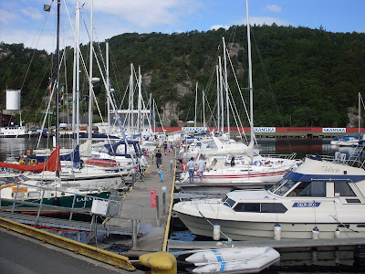
Haugesund's visitor harbour.

Storhaugøy lighthouse, also called “Tonjer”

Old "Cappy" has seen Happier days.

Haugesund's visitor harbour.

Haugesund - the maritime atmosphere is still obvious along the docks.
It is magical to wake up a calm morning in Ognahamn. The sea is smooth and glittering, the sun shines, but yet only gives us a hint of the summer to come. The occasional morning traffic that sweep past on the E39, nearby at the hillside, makes us sense the nature with more intensity, strangely enough. We are close by the road, but it seems to belong to another dimension. The calm weather tells us there will be no sailing today , but never mind, we've probably sailed enough for a while, and the wide Boknafjorden in calm sea is not to disdain, either. We cast off, and our slim hull rushes off, driven by a nice forward propulsion. After some disagreement about course and calibration, the autopilot finally understands us, and we enjoy our breakfast on the completely calm fjord, only occasional casting a glance trough the windscreen. We approaches the beautiful island Brimse, east of Rennesøy, when the crew suddenly makes a disturbing discovery. In our cabin, there is water all over, and it is not due to a leaking water tank or something. This is seawater. The thought of some fatal leakage fills the skipper's mind, and I remember countless stories of "new boat home passages” leading to abject failure. Fortunately, the boat has the luxury of a bilge pump, and the skipper runs to it, trying desperately to dry out the boat. The crew monitors the water level. Does the water still rise? The skipper pumps like hell, and after a while, the crew gives him hope after all. The water level drops, the pump has done it's duty, at least we're not sinking. When the bilge is finally emptied, we nevertheless note that water is still trickling in from somewhere. The enjoyment of the beautiful morning has to wait, and we start searching for the leakage. Was it naive to buy the boat unseen? Have I bought a pig in a poke, or a hulk that will not float? In the cabin we find nothing. Could it be the shaft? A plunge into the inspection hatch gives us the answer, and it is simple and rather banal. The lid on the grease cup has not been properly screwed on, and from this cup seawater trickles in. Luckily we find the missing lid, and after some fumble, the leakage is eliminated. At least we think so. Some days later the bilge is inundated ones again and a new inspection reveals a broken pipe from where the seawater trickles gently. Ones again the boat owner sees his boat on the depths of the ocean, especially when the pipe breaks completely when he touches it. His finger is immediately turned into a human plug, but fortunately. The designer, E.G. van de Stadt, had his way of doing things. The leak seems to be just in the waterline or even slightly above, and a small box built around the pipe is probably all that would be filled, at worst. Some days later the broken pipe is replaced without problem. And this is how the first chapter ends of my life together with the legendary Dutch ocean cruiser, Pionier 9, production number1520, year 1964. We have sailed 180 nautical mils along most of the Norwegian west coast, and finally, after less than three days, we are home. The crew and the skipper says goodbye – still friends after completed deeds. It is the 16th of May 2011. The Norwegian Constitution Day is coming, with the mandatory tribute to the great Norwegian poet, Henrik Wergeland, a spokesman for freedom, justice and human rights. Meanwhile, my modern vintage boat seems to be a bit in a daze. But now the senior yachtsmen, the real old-timers, come limping along the pier with or without a walking stick. Yes, they know this fast ocean cruiser design, and it gave them some strong competition in the 60th and 70th, it was in the Bergen-area, as far as they remember. Yes, it’s a nice boat – they nod approvingly – it reminds us a little of the old days. And my Pionier 9 – at once – seems to feel a little more at home. Remembering my dear folkboat Maritornes, named after the coarse but merciful harlot in Don Quixote, I think I'll name this new boat after the incomparable Dorotea.
 Ognahamn. View towards Bokn.


Sunday 18 September 2011
Egersund
Visitor's pier, Natural harbour, Sea chart, Tourist info., Museums in the region


Egersund visitor's harbour.
58.26,90 N 05.59,27 E. Sheltered by Eigerøya, the charming town of Egersund offers the safest possible harbour. The visitor’s pier is roomy, and you probably will find a berth even in the busy season. The harbour has an inviting sanitary installation, and you can enjoy staying almost in the center of town. Egersund is a popular port of call, due to the exposed, naked coastline both to the northwest and to the southeast. North of Egersund you have Jæren, 40 nautical miles with few recommendable harbours before you reach Tananger or the island Rott – near Stavanger. The exception is Sirevåg, but from Egersund this is just “around the corner”. To the south-east you have an open stretch until the small "slow city" of Sogndalstrand. In nice weather, a visit to the tiny Nesvåg bay with its sea and motor museum is an option, though. Farther to the southeast, the island Hidra with Kirkehavn or Rasvågen, is highly recommended.
In Egersund, a stroll trough the many narrow streets is, for sure, a must. The faience museum, displaying 132-years of production, is also recommended. Some yachtsmen might be more interested, though, in Bilstadhuset, Nygaten 14, not only with old furnishings but a complete sailmaker's loft from the 1890th. Egersund and the region called Dalane is not really part of the south coast, called Sørlandet, but in many aspects the town looks like one of the small white south-coast towns. In the narrow, sheltered sound too, one is reminded of Sørlandet. If you don’t want to spend the night in the visitor's harbour, the beautiful sound offers safe anchorage or even a free, public jetty in several coves. Gyarhamn to the north is nice (58.27,86 N, 05.53,23 E), or try one of the coves nearby. To the south, near the mouth of the sound, is Auglend (58.24,43 N 05.58,53 E), but the entering to this natural harbour is somewhat exposed. If weather permitting, entering Midbrødvågen and the impressing Eigerøy Lighthouse is another tempting option (58.25,60N 05.52,34E).
Norwegian/Norsk:
I ly av Eigerøya tilbyr Egersund en havn så trygg som mulig er. Gjestebrygga er rommlig og du får trolig plass selv i travleste sesongen. Her er et flott senitæranlegg og du kan glede deg over å "bo" midt i byen. Egersund er en populær by å anløpe blant annet på grunn av utsatte, åpne havstrekninger både mot nordvest og sørøst. Nord for sundet ligger Jæren, 40 nautiske mil med få gode havner før Tananger og den vesle øya Rott, nær Stavanger. Unntaket er først og fremst Sirevåg, men fra Egersund er jo dette like om hjørnet. Mot sørøst er det åpent hav helt til den vesle, "slow city"-byen Sogndalstrand. I bra vær kan du på veien stikke innom den vesle Nesvåg, der du blant annet kan besøke et sjø- og motormuseum. Lengre mot sørøst ligger øya Hidra med Kirkhavn eller Rasvågen som kan anbefales på det varmeste som anløpssteder. I Egersund er en slentrende tur eller to i de smale gatene obligatorisk. Fajansemuseet med 132 års produksjon utstilt, kan også anbefales. Noen båtfolk vil vel likevel være mer intressert i Bilstadhuset, Nygaten 14., som ikke bare har gammelt interiør, men et komplett seilmakerverksted fra 1890-årene. Egersund og regionen Dalane er selvfølgelig ikke en del av Sørlandet, men har litt av Sørlandsbyenes preg. Det samme gjelder sundet som byen ligger i. Dersom du ikke ønsker å overnatte i gjestehavna, er her mange gratis ankringsplasser ute i sundet, noen bukter kan også tilby fine gjestebrygger. Gyarhamn nord i sundet er flott, eller du kan prøve en av buktene like ved. Sør i sundet ligger Auglend, men åpningen til denne naturhavna skal være litt utsatt. Dersom været tillater det er en annen mulighet å entre Midbrødvågen og det imponerende Eigerøy fyr.

Gyarhamn, north in the sound.

"Fri" coming alongside in Egersund after a choppy voyage from Stavanger, 2011.

Tuesday 24 May 2011
Ognahamn / Kjeøyvågen
Vistitor pier, natural harbour, Sea chart

Ognahamn, view from Kjeøya towards Austre Bokn.
59°15,504’N 05°27,576’E. Ognahamn is north of Boknafjorden, just north of the bridge that connects Austre Bokn with Ognøy. The water south of the bridge is Falkeidflæet (flæ = a wide water), and in the northwest Boknaflæet. West of Boknalæet, there are many beautiful islands, bays and coves.
Motorists passing Ognahamn on the main road, E39, will see the beautiful Ognahamn cove just down the hillside, and a visit will be a good idea. From the sea it is far more difficult to discover this natural harbour because the entrance is narrow. For deep draughters It may seems scary to enter, but the depth is 1.5 meters in the entrance, and deeper further on (see key map). Sailboats can use the pier just inside the entrance; here the depth is 2 meters, while only 1 meter at the northern pier.
Norwegian/Norsk:
Ognahamn ligger nord av Boknafjorden, like forbi brua som forbinder Austre Bokn med Ognøy. Farvannet sør for brua heter Falkeidflæet (flæ=vid vannflate), i nordvest Boknaflæet. Vest av Boknaflæet finner du usedvanlig mange flotte øyer, bukter og viker. Bilister som passerer Ognahamn på E39 kan se den flotte hamna like nedenfor veien, og en stopp vil være en god ide. Fra sjøen er denne vesle bukta vanskeligere å oppdage fordi innseilingen er så smal. For båter som stikker dypt kan den virke skummel, men her skal være iallfall 1,5 meter midt i løpet, og dypere - 2 meter - like innenfor, men bare 1 meter ved den nordlige brygga.

Ognahamn was previously a smallholding, and near the toilet, located by the road, there are several ruins that testify to this. Ognahamn offers no garbage container, so don’t forget to gather your trash and take it with you when leaving. The Outdoor Counsel (No) runs the recreation area. The Kårstø gas terminal is situated just east of Ognøy. This won't cause you any trouble, but be aware of gas tankers when you navigate trough the waters south of the bridge.
I gamledager var Ognahamn en husmannsplass, og like ved dagens toalett, like ved veien, ligger det flere ruiner som vitner om dette. Ognahamn har ellers ingen bossdunk, så ikke glem å ta med deg etterlatenskapene dine. Friluftsrådet driver plassen som er et friområde.
Kårstø gassterminal ligger like øst av Ognøy. Dette vil ikke plage deg, men vær oppmerksom på eventuelle gasstankere når du navigerer gjennom farvannet sør for brua.

Kjeøyvågen ("Kid island bay")
The sea chart indicates anchorage also in Kjeøyvågen, east of the island Kjeøya. This bay may be preferable for larger boats, but you are exposed to northern winds, and a somewhat loose seabed makes the anchorage less secure. This inlet also offers some underwater rocks. Stay close to Kjeøya when entering. See also Sailing the Fjords: Fårøy / Hamnarholmen and Toftøyvågen. Another nice visitor's pier is Austerøyna, north of Boknaflæet. 59.17,774 N 05.26,935 E. You'll find a pier also to the south-east of Vesterøyna, the depth here is unknown to me.
Sjøkartet viser ankerplass også i Kjeøyvågen, øst av Kjeøya. Denne vågen kan være å foretrekke for større båter, men du vil være noe utsatt for nordlige vinder og sjøbunnen skal være noe løs med dårlig feste. Her er også noen grunner. Hold nær Kjeøya når du går inn. Se ellers innlegg om Fårøy/Hamnarholmen og Toftøyvågen, begge i nærheten. En annen fin plass i nærheten, med flytebrygge, er Austerøyna, nord av Boknaflæeter. Også sørøst på Vesterøyna er det en brygge med uviss dybde.
Sunday 8 May 2011
Skartveitvågen / Halsnøy / Fisterøyane
Sea chart, Visitor berths, Shop and visitor berths (No)


59°11,856’ N 05°57,565’ E. Skartveit guest harbour is on the east side of Halsnøy. The bay is a hub for boaters, not surprising since the attractive areas Fisterøyane, Randøy, Fogn and Sjernarøy are not far away. Skartveit has a village shop with post office, fuel and a spacious guest harbour with pontoons. Additional services – a café and more – are now developed. A small beach nearby is nice for children. However, Skartveitvågen is definitively not the place if you seek is peace and quiet.
Halsnøy can be seen from great distance because of a distinctive mountaintop, Eikefjellet, reaching 211 meters above sea level. From Skartveit there is a marked trail leading to the summit where you are invited to sign a visitor’s book. The trail turns to the south and west, passing Nødviga, nice for swimming. The whole trip takes about 2,5 hours.
Norwegian/Norsk:
Den rummelige Skartveit gjestehavn ligger på østsida av Halsnøy. Bukta er et skikkelig nav for båtfolk, ikke så rart siden de attraktive Fisterøyane, Randøy, Fogn og Sjernarøyane, ikke er langt unna. Skartveit har også en grei butikk med postkontor og drivstoff. Her er også kafe m.m. En liten strand kan være fin for småbarn om her ikke er for mye graps fra båtene. Likevel, Skartveitvågen er absolutt ikke plassen om du søker fred og ro.
Halsnøy kan beskues fra lang avstgand på grunn av sin karakteristiske fjelltopp, Eikefjellet - 211 meter høyt. Fra Skartveit er det en merket sti til toppen der du kan skrive deg inn i ei bok. Stien går sørover og så mot vest, forbi Nødviga der det er fint å svømme. Turen tar 2,5 timer omlag.
Monday 2 May 2011
Børøyholmane / Fisterøyane
Sea chart, Visitor pier, Natural harbour


59°10,409’N 06°00,339’E. Børøyholmane in Fisterfjorden, south of Randøy, is a popular recreation area with a guest pier at Søre Børøyholmen (the southern island) and bollards along the shore. The islands offer nice coves, sloop rocks and footpaths, and are suitable for families with children.
Norwegian/Norsk:
Børøyholmane i Fisterfjorden, sør av Randøy, er et populært friområde med gjestebrygge ved Søre Børøyholmen, og fortøyningsbolter langs land. Her er fine bukter, svaberg og gangstier, og plassen passer godt for familier.
Norwegian/Norsk:
Børøyholmane i Fisterfjorden, sør av Randøy, er et populært friområde med gjestebrygge ved Søre Børøyholmen, og fortøyningsbolter langs land. Her er fine bukter, svaberg og gangstier, og plassen passer godt for familier.

Børøyholmane offers several mooring options.
Nedstrand
 |
| Nedstrand |
Norwegian/Norsk:
Nedstrand, nord i Nedstrandsfjorden, har trygge og moderne gjesteplasser for båtfolk. Stedet er en hyggelig og sjarmerende ørliten "by". Her er flere rekreasjonsmuligheter i området, både langs sjøen og oppover i liene.


Saturday 12 March 2011
The Art of Floating: The Boat who wouldn’t Float
In this interview the Canadian author Farley Mowat talkes about the southwest coast of Newfoundland where he sailed in the early 1960s. He portrays this coast both in Bay of Spirits: A Love Story (2006) and in earlier books like This Rock Within the Sea: A Heritage Lost (1968), The Boat Who Wouldn't Float (1969), and A Whale for the Killing (1972).
The literary genre of small craft voyaging has its clichés, and after a while the reader might fall into boredom despite her or his passion for sailing. After enduring innumerable narratives of dreams made true, countless trough descriptions of buying the boat, the fitting out, the brewing of the first storm, riding it out – etc. etc, one has to stifle a yawn. Unfortunately, the author’s personal adventure isn’t always converted into a thrill of reading, and after a while, even the interest in sweet – belated – South Sea dreams, slowly fades out. This is when Farley Mowat’s The Boat who wouldn’t Float (1969) has something to offer. In this book the enticing Caribbean islands are never to be reached. Instead, the Canadian author and his friend – and later on his girlfriend – are being enslaved by their old, leaking schooner – the boat who wouldn’t float. Their original dream is turned into a never-ending struggle against stinking fish entrails, currents, fog and gales on the weather-beaten south coast of Newfoundland. What makes the book worth reading is first and foremost Mowat’s charming self-irony and sense of humour. The schooner – “Happy Adventure” – more and more acts like a stubborn human being – and she refuses to leave her native coast, rather she’ll sink. With both sympathy and hilarious comedy, Mowat portrays the peculiar out port inhabitants of this coast. Another aspect is Mowat’s mixed feelings for the boat that enslaved him. The book, after all, is written “For her friends who have loved her despite her faults.”
Friday 11 February 2011
Sandnes, Gandsfjorden
Visitor berths, Sea chart, Natural harbours


Albin Express, heading towards Gandsfjorden.
58°51,186'N 05°44,712'E. Sandnes: To be honest, it's far easier to take the train from Sandnes to Stavanger, then sailing your own boat the eight nautical miles, approximately, from the head of Gandsfjorden. This is why – among yachters married by force to a harbour near Sandnes – Gandsfjorden has a somewhat stained reputation. Or to be more specific: The distance run before reaching the archipelago off Stavanger and the Ryfylke fjords, will cost them at least one an a half hour, and homewards the fjord seems to be even more outstretched, for some mysterious reason. If you are a visitor, though, you don’t need to be concerned about these local everyday worries. Instead you can enjoy what the Gandsfjord – and the town of Sandnes – has to offer. With a little luck you can steer on course both in and out of the fjord. Apart from the last distance, the fjord is relatively wide. In case of easterly winds, the high mountain on the eastern shore, will course some turbulence and gusts, fun – if your are in the right mood. A strong headwind is worse because waves will build up. Still it's seldom impossible to beat against the wind.
If you wish to let go your anchor before reaching Sandnes, several places can be recommended. In the mouth of the fjord lies the amusing island Usken (Uskjo): Leirvågen, sheltered by the islet "Snekka", (58°57,536'N 05°48,829'E ) is a perfect anchorage and a nice swimming spot. Vadholmen on the east shore is a recreation area with public pier, sheltered from all winds (58°57,338'N, 05°50,319E). Stora Marøy is suitable for smaller boats (58°57,774'N 05°46,935'E). At approximately 58°55,484’ N, you’ll find a small nice and popular beach – Vaulen. Here, the best anchorage probably is in the bay, inside of the small tongue of land. You’ll find safe anchorage also in Gauselvågen, six cable lengths to the south, but be aware of shallow water. Some shallows are marked with unofficial sticks. South in the bay, you’ll fins a nice “Robinson”-islet, Gauselholmen. If your draft is moderat, it should be possible to make fast to a small stone jetty on the western shore. You’ll probably have the whole islet for yourselves. If this doesn’t suit you, try Dalsvågen on the opposite shore of Gandsfjorden – the small cove has a nice, sandy beech. Another popular swimming spot is Holmavigå – one nautical mile to the south.

"Mrs Robinson and Man Friday" enjoying their twosomeness at Gauselholmen, Gandsfjorden.

Dalsvågen is a nice cove with a small sandy beech.
The town of Sandnes is situated at the head of the fjord. It has a roomy and excellent guest marina (58.51.144N 5.44.543E). Previously, Sandnes (Eng.) was often considered to be an ugly town, especially the port area. Today this is not the case at all. A culture centre and several restaurants and cafés, lies only a stone’s throw from the guest marina. Here, if you are lucky, you can also admire the veteran boat, Oscar II (No.).

The guest harbour.
Sandnes has several good art galleries.
Sandnes is known first and foremost to be a town of shopkeepers – forthcoming and friendly. The town also was the home of Norway’s most important bicycle industry, but the production is now moved from Sandnes, after more than 100 years. Due to natural recourses, Sandnes also had an important pottery industry. This too is history for the most part. Potter Stein Em. Simonsen though, maintain the tradition, and has a shop in the main shopping street, Langata. One of the newest attractions in Sandnes is the Science Centre. It has gained enormous popularity both among grownups and children, and is highly recommended.
Links:
-(No.) - by the guest marina.
-centre for art and film.
-Sandnes (No., pdf)
Subscribe to:
Posts (Atom)